
Walk a Niles Street by Address
A useful Niles street directory search follows the property, then tests any person-name clue against another dated source. Enter the house number and bare street name in the Cook County Assessor Property Search. The Assessor identifies a parcel, its Property Index Number, or PIN, taxpayer, site address, mailing address, class, values, and other card details. Ownership and residence are not the same fact. A taxpayer may receive mail elsewhere, and a person at the site may not own the land.
Next, place the parcel on a map and preserve its identifiers before changing systems. The PIN and legal description survive spelling changes better than a street string. Use the following order when searching by street:
- Search the exact number and street name in the Assessor. Copy the PIN, site address, mailing address, taxpayer name, and class.
- Open CookViewer or the Village GIS map. Confirm the lot, road, and nearby parcel context.
- Carry the owner name, PIN, subdivision, lot, and block to the Cook County Clerk recording route.
- Check Niles permits or request existing address records through Village FOIA when the portal does not supply them.
- Use the voter tool only for an individual with all required details. For older occupants, ask about Haines or telephone directories.
This chain answers different questions at each step. It can show who is tied to a parcel, what was recorded against the land, and what dated sources place a name at the address. It cannot produce a complete current household roll.
Search Niles Assessor Street Fields
The Assessor's address form has unusually useful range controls for a Niles street directory. Its street-name warning matters: type only the name, without a suffix such as Avenue or Street. A short house-number range can expose separate parcel cards, while unit and direction fields keep similar addresses apart. The advanced form also offers Niles Township, neighborhood, property class, partial-PIN, PIN-range, applicant, attorney, and appeal modes. There is no current owner-name box on that form.
| Portal control | Use on a Niles street | Entry rule |
|---|---|---|
| House Number | Single parcel or range start | Required numeric value |
| House Number end | Short street segment | Optional numeric endpoint |
| Direction | Separates N, S, E, W, NE, NW | Optional menu |
| Unit Number | Distinguishes condo or apartment parcels | Optional text |
| Street Name | Main address key | Name only, no suffix |
| City | Tests the official place value | Required |
| PIN | Returns to one stable parcel | Fourteen digits in PIN mode |
Read the result as an inventory. Record the year of the displayed values and any exemption, appeal, sale, measurement, or map field that matters. Do not collapse the mailing and site addresses into one. That distinction is central to reliable by-address research.
Property class also needs care. The advanced portal exposes a long exact class list, from vacant and residential codes through commercial and other uses. Class can narrow a large address range, but it describes assessment treatment rather than the people tied to a parcel. Neighborhood search works only after selecting Niles Township. Applicant, attorney, and appeal modes belong to assessment proceedings, so a name there may represent a tax appeal role rather than an owner. Capture the mode used with every result. A screenshot or note that omits the search mode can make two very different name matches look alike.
See the live Assessor advanced search before relying on a saved field list.
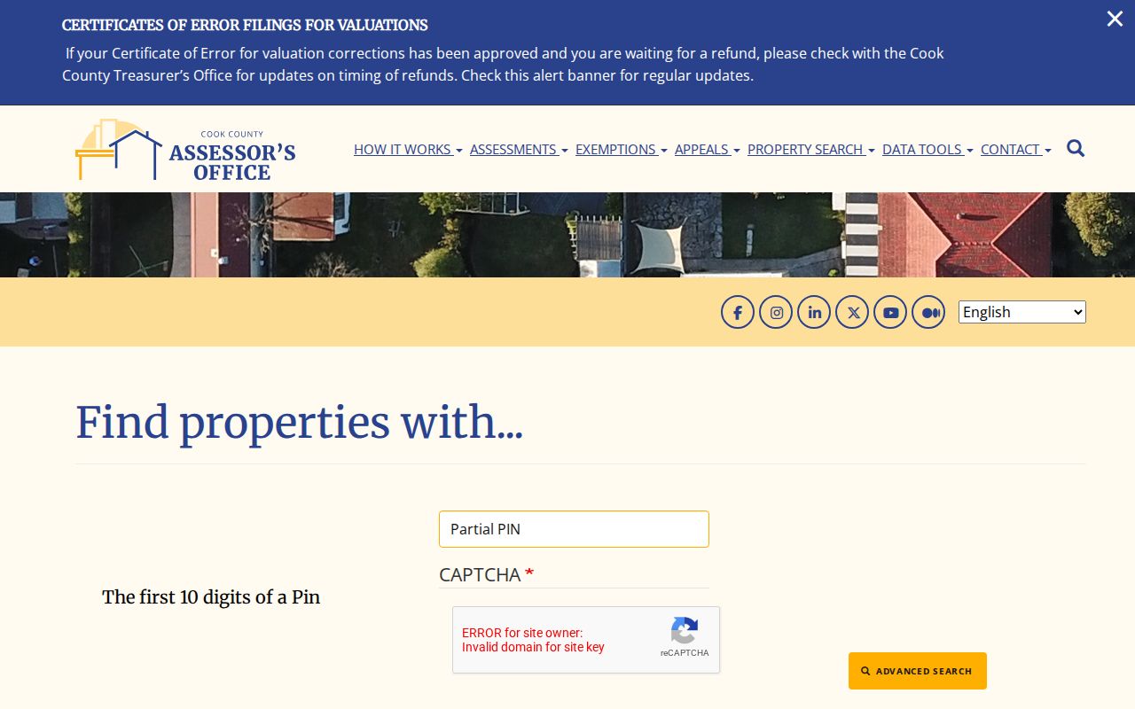
The captured form confirms the range and parcel modes that make a street segment easier to inspect one property card at a time.
Niles Street Directory Terms
Four terms prevent common address mistakes. They link the visible house number to the county's land system and to old address sources.
- Parcel
- A mapped unit of land that receives a PIN and property card; one building or address can involve more than one parcel.
- Situs address
- The physical site address shown for the parcel, distinct from the address where the tax bill is mailed.
- Plat
- A recorded map that divides land into lots, blocks, streets, or easements and can preserve an older legal identity.
- Criss-cross directory
- A directory arranged by street and house number, allowing an address-to-name search rather than a name-to-address search.
When the spelling or number in an older item does not match today's street directory, retain the original form. Use the legal description, PIN, map landmarks, and later records to prove continuity.
Map Niles Streets and Parcels
CookViewer supplies the county parcel context. Zoom to Niles, select a parcel, and follow its property link when available. The Village of Niles GIS Viewer adds local map context. The Village says its former Atlas tools have moved to a Viewer still under development, so a saved workflow may change.
The official Niles maps catalog remains a strong fallback. Static street, zoning, neighborhood, tax-increment, garbage, and survey-control maps can orient a parcel when the interactive map stalls. Milwaukee, Touhy, Oakton, Dempster, Golf, Howard, Harlem, and Waukegan form useful reference corridors. Parks and cemeteries can also anchor an old notice whose house number is unclear.
The maps catalog image below shows where Niles groups these official map products.
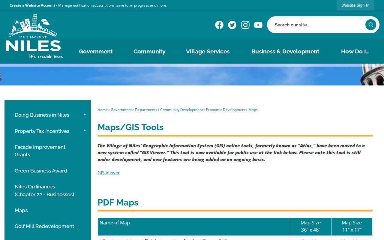
Those fixed maps preserve context while the interactive Viewer changes, but they do not name current residents.
For a road segment, click one parcel at a time and make a small working table with its displayed PIN, site address, class, and map position. Parcels sharing a boundary are not always assigned to the same street, and a parcel across the road may face a side street. Corner lots make this clear. The official Street Map also identifies cemeteries including St. Adalbert, Maryhill, Beth Jacob, and Ridgewood. Such stable map features can help normalize an old newspaper notice or family paper, especially when its postal city or street wording differs from today's Assessor entry.
The Village's live GIS interface is available from the same official system.
Use map clicks to collect public parcel identifiers, then verify the fields on the Assessor card instead of treating map labels as a household list.
Note: The unattended research did not verify a buffer or multi-parcel selection tool in the current Village Viewer.
Request Niles GIS Street Data
If the standard maps do not answer the question, the Village GIS request page explains the next channel. Standard maps are free. Native ESRI data goes through the Niles NextRequest FOIA system, with file geodatabase preferred and shapefile available by request. The Village also notes that a nominal fee may apply and that map accuracy has limits.
The official request page preserves those format and access details.
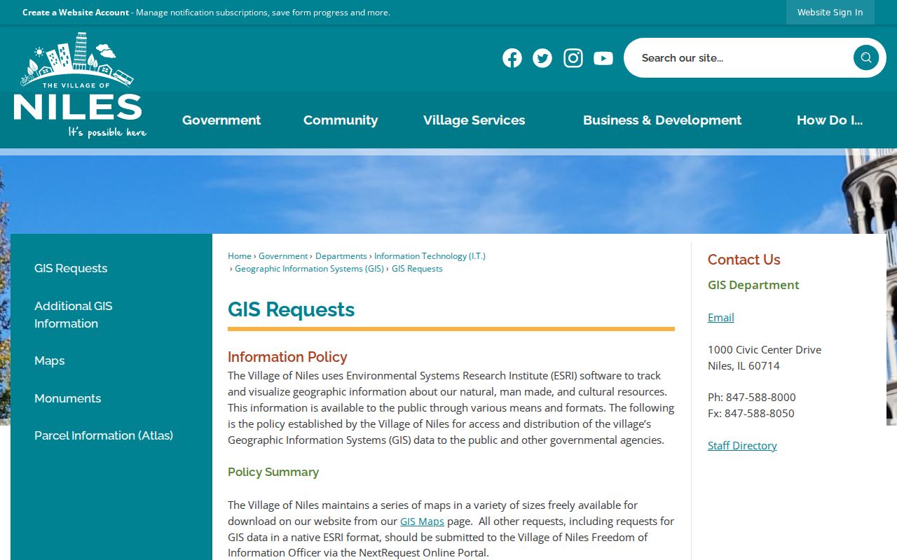
A focused request should name an existing map or dataset, geographic extent, date range, and preferred format. Ask for records, not for staff to create a new street directory.
Niles Records Indexed by Street
No public roll gives every occupant along a road. Instead, Niles and Cook County keep separate address-keyed records. Each one contributes a narrow fact, with a different access route and update cycle.
| Record Set | Keeper | What It Shows | Access |
|---|---|---|---|
| Property cards | Cook County Assessor | PIN, taxpayer, site and mailing addresses, class, values | Free portal with CAPTCHA |
| Parcel maps | Cook County and Village GIS | Boundaries, roads, map layers, nearby parcels | Free viewers and static PDFs |
| Deeds and recordings | Cook County Clerk | Recorded parties, dates, legal description, document trail | Portal; office, mail, and copy fallback |
| Voter verification | Illinois State Board of Elections | One person's status after required identity fields | Not a public street browse |
| Permits and inspections | Niles Community Development | Address, owner or applicant, work, status, dates | Self-service account, paper/email, or FOIA |
| Historical directories | Niles library and Historical Society | Dated names, phone listings, business or community ties | Reference inquiry, microfilm, and databases |
The PIN ties the parcel card to deeds and maps. The street string ties permits and old publications to the site, but it can drift. For modern property facts, the Assessor and Clerk are stronger than an undated directory listing. For an older household clue, the historical shelf may be the only address-to-name route.
Access channels matter as much as record types. The Assessor and both map systems are online. Recordings have a portal, but the live search screen returned an access-style response during research, so the Clerk's office, mail channel, and fee schedule remain necessary. Niles permits begin in Citizen Self-Service, with paper or email options and FOIA for existing responsive files. Older address books may require a library shelf check. The Historical Society accepts remote inquiries and special appointments. A complete street directory workflow keeps these fallbacks beside the web links instead of assuming that every record image is online.
Follow Deeds Along Niles Streets
The Cook County recording index is based on recorded parties and land descriptions, not always the current house number. Start with the Assessor's taxpayer name and legal description. In the Cook County Clerk recordings route, locate a purchase deed, note its grantee, grantor, recording date, and land description, then test the seller as a grantee in an earlier transfer. A grantor conveys an interest; a grantee receives it.
Search spouse names, estates, trustees, and name variants where the record supports them. Mortgages, releases, liens, easements, and plats may clarify the parcel trail, but their parties are not automatically owners or residents. The former Recorder of Deeds was absorbed by the Cook County Clerk on December 7, 2020. Old references to the Recorder should therefore be routed to the Clerk's Recordings Division.
The live recording search did not expose its fields during research. Preserve the portal URL, then use the recordings office, mail request, fee schedule, or in-person copy channel when it fails. That fallback is part of a complete Niles by-street search.
A deed index hit and a recorded image serve different purposes. The index helps locate a document by party, type, date, and land reference. The image or certified copy carries the actual instrument. If a transfer matters to an estate or family-history question, request the document rather than relying on a short index line. Keep book and page or document number, recording date, grantor, grantee, and full legal description together. Then compare the description with the current Assessor parcel. A subdivision lot may remain stable even when the public-facing address changes.
Niles Permits Preserve Address Clues
A deed can be quiet while a building changes. The Niles permit system accepts online applications and also documents paper or email routes. Its application fields include the property address, owner, applicant, contractor, work description, cost, trade or license details, signatures, and dates. These are project facts, not proof that any named person occupied the site.
The official permit page shows the current route into applications and inspections.
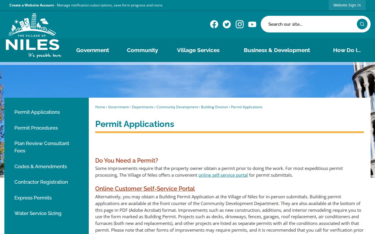
If the portal or an account does not reveal an older record, submit a focused Village FOIA request for existing applications, reviews, inspections, and issued permits at one address and within a defined date range. Exempt details may be withheld.
The Village FOIA channel is NextRequest. The current 2026-27 policy says fees are being waived while retaining a detailed fee framework, response and inspection forms, and an appeal path. Phrase the request around records that already exist. Include the exact address, any old variant, a practical span of dates, and document categories. Avoid asking staff to decide who lived there. The responsive permit itself may show an owner, applicant, or contractor, and each role must stay labeled. Inspection status can date a project, but it does not establish the date a household arrived or left.
Niles Center in Old Directories
Modern postal wording can hide an old Niles address. A 1987 Niles Bugle article described a local telephone-directory tradition dating to 1909, when the community was called Niles Center. It also identified the Near North Suburban Regional White Pages serving Niles, Lincolnwood, and Morton Grove. This supports a historical search method, not a claim that a complete 1909 volume survives.
The 1999 official library inventory listed Cook County north-suburbs directories and Haines material, but neither that inventory nor the current library page publishes an exact year-by-year run. Ask Niles-Maine District Library reference staff which print or reverse volumes are now held. A reverse, or criss-cross, volume is arranged by address. When an old listing supplies a person name, verify it in a dated newspaper, census, deed, cemetery record, or permit.
The modern Niles city directory collections treatment explains how to read and cite those volumes without turning a historical listing into a current-residence claim.
Historical continuity also depends on geography. Niles incorporated in August 1899, while Niles Township records reach back to 1850. A source labeled by township can cover land outside today's Village. Postal naming can cross municipal lines as well. When the old item says Niles Center, North Suburbs, or a nearby postal city, do not modernize it in the transcript. Compare the original number and road with the official street map, census boundary description, directory title, deed legal description, and current parcel. The research found no verified village-wide street renumbering year, so a changed number must be proved address by address rather than assigned to an invented event.
Niles Voter Lookup Is Individual
The Illinois voter registration lookup requires first name, last name, birth date, and ZIP according to the official guide. It verifies an individual submission. It does not let a reader browse a Niles street directory or retrieve every voter on a block. A match also does not prove present physical presence or reveal anyone's ballot choice.
Illinois voter-file access under 10 ILCS 5/1A-25 is limited to registered political committees for bona fide political or National Voter Registration Act purposes. The state charges specified fees, withholds birth dates, and restricts disclosed fields and uses. Phone, email, Social Security number, full birth date, and protected-voter information are not a public street list.
The safest voter use on a street page is self-verification. A person who supplies the required name, birth date, and five-digit ZIP can check their registration through the official tool. If an eligible committee needs a lawful file, it follows the State Board of Elections request process and its purpose rules. For ordinary family or property research, a failed voter search should not trigger a broader hunt for private data. Return to parcel, deed, permit, directory, and newspaper sources, and keep each source's date in view.
Illinois also operates an Address Confidentiality Program through the Attorney General under the Address Confidentiality Act. It helps eligible survivors use a substitute address in specified dealings. A protected address that does not appear in an ordinary result is an intended safeguard. Never try to reverse that protection through linked records.
Limits of a Niles Street Directory
A property card does not name every person at the site. A deed identifies a recorded party, and a permit may name an applicant or contractor. Neither proves who sleeps at an address today. Utility and delivery customer lists are not public resident sources. Driver-address data is restricted by federal law. Illinois Address Confidentiality Program participants, protected voters, restricted vital records, and sealed or juvenile court matters may be absent for sound legal reasons.
Use the Niles street directory process for parcel history, family research, civic transparency, or careful verification of a transaction. Correct errors with the office that produced the record. Do not publish a guessed household roster or merge unrelated names merely because they share a mailing address.
Source dates belong in every note. Assessment values, a deed's recording date, a permit inspection, and a printed phone listing can describe four different moments. When two records disagree, compare their dates, identifiers, and stated roles before choosing one. Contact the Assessor about a parcel-card error, the Clerk about an indexed recording, and the Village about a permit or GIS record. The custodian can explain its own fields and correction route; a third-party summary cannot.
Lawful use. Niles address records are for lawful personal research. Never use a street search to stalk, harass, threaten, or expose a protected person.